
There’s something great about hiking up mountains. You struggle up with sweat dripping down your forehead, your cheeks red, your lungs bursting, wondering why you ever thought this was a good idea… but then you reach the top to look out over the land around you and suddenly, it all seems worth it. You’re filled with a sense of peace, lifted away from everything down below and allowed to look at the world from a different perspective. You’re on top of everything.
The town I’m living in, Blighty, is a tiny place where the land is as flat as the eye can see. So, a few weeks ago when I had a long weekend off, Chris and I decided to drive 3 hours to the town of Mount Beauty in Victoria. I really did feel a million miles away from Blighty. Mt Beauty, which is surrounded by mountains and trees, has a nice alpine feel to it, and isn’t far away from Mt Bogong, proudly the highest peak in Victoria.
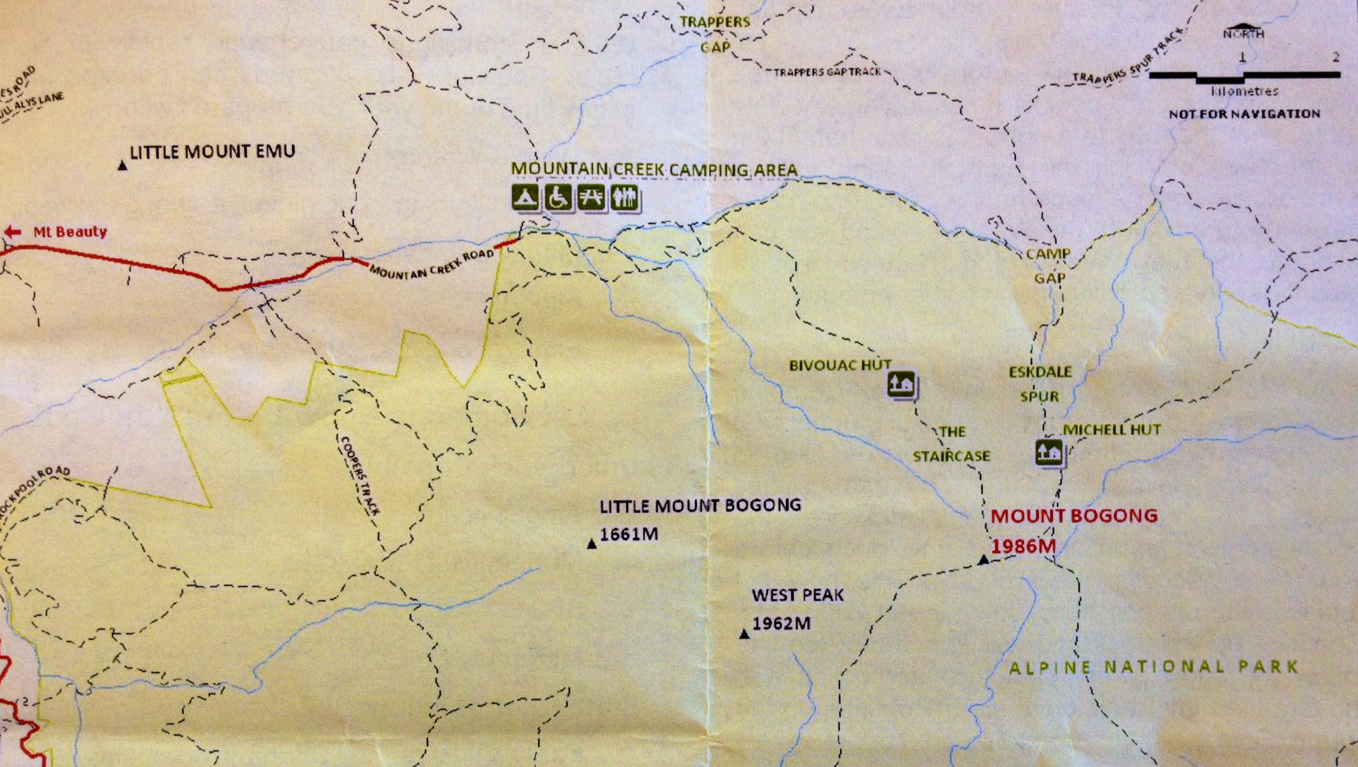
We planned to do a day walk to the top of the 1986m peak, which can be completed as a loop. I’m not actually sure what the official distance is, while researching the walk one person claimed it was 18km while another said it was 25km, quite a difference! The walk started in the Mount Bogong National Park at the Mountain Creek Camping Area, about 12km away from Tawonga. So we went there in our campervan and stayed the night before we planned to start the walk.
But in the morning we were awoken to the sound of heavy rain on the roof. This was the last thing we needed! We looked up at the peak of the mountain to see it was masked in thick cloud. I’ve been up mountains in bad vis before and there was no way I was going to get soaking wet and cold only to get up there and not be able to see a thing! But thankfully we had a day to spare so we spent the day in Mt Beauty instead. We went to a café, ate some home made fudge and ice cream, and had a good chat with the nice couple who ran the I site.

The next day the sun was out and we were ready to go. We started at 9am and decided to attack the hike by going up the Staircase Spur. A very steep 6km track up to the summit. The track zig zags it’s way up through the trees. It is steep but luckily it flattens out every so often, otherwise I don’t know if I’d have made it!

Just over half way you reach a hut, a good place to stop for a break. But this is just a hut for day use or shelter in bad weather, it’s not for sleeping in overnight.
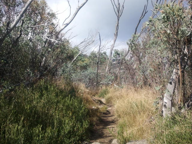
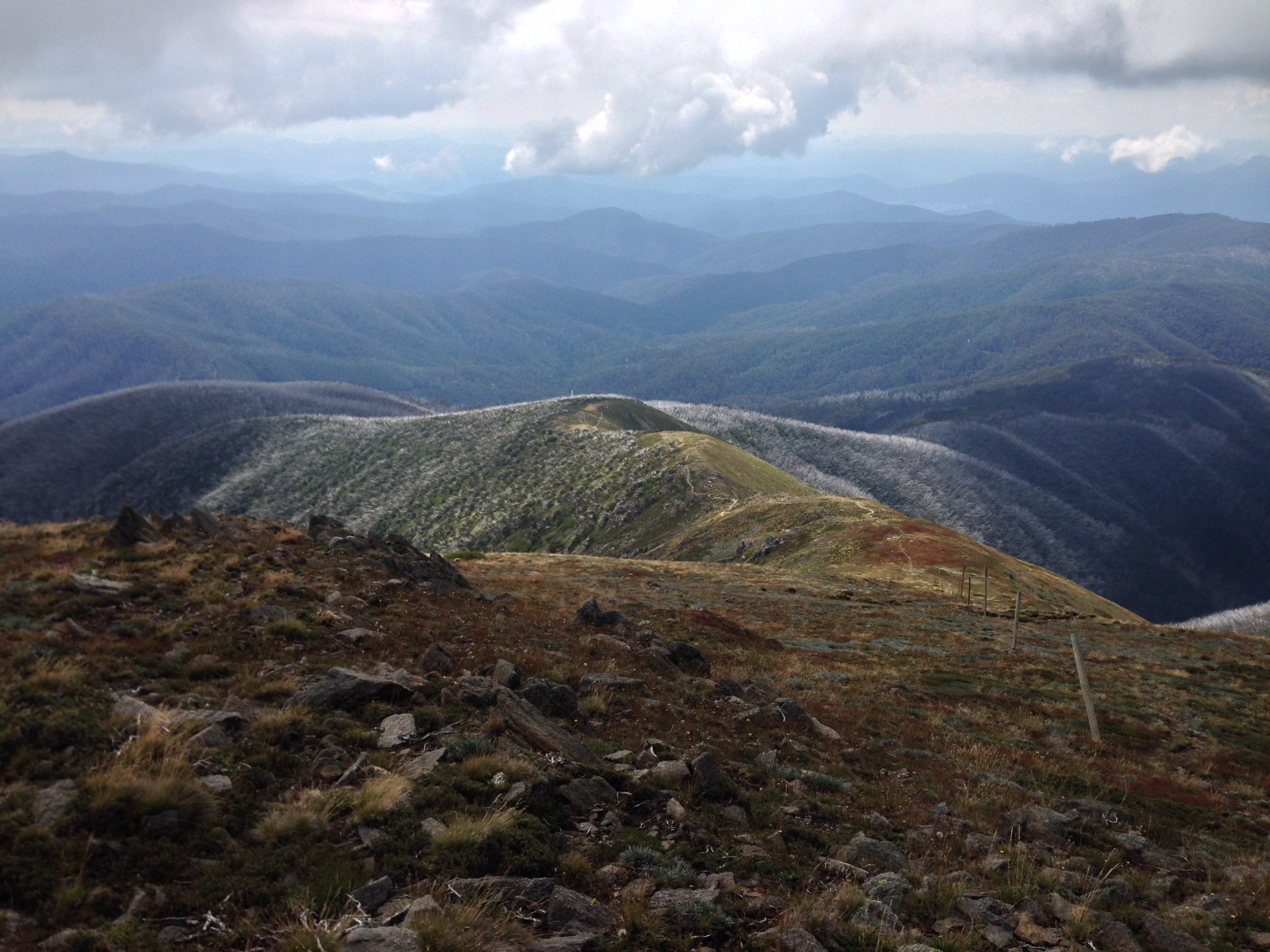
Once you pass the hut the vegetation starts to change. The trees become smaller and then turn into shrubs and bushes. Eventually you come out the top and look to your left and the view is pretty spectacular.
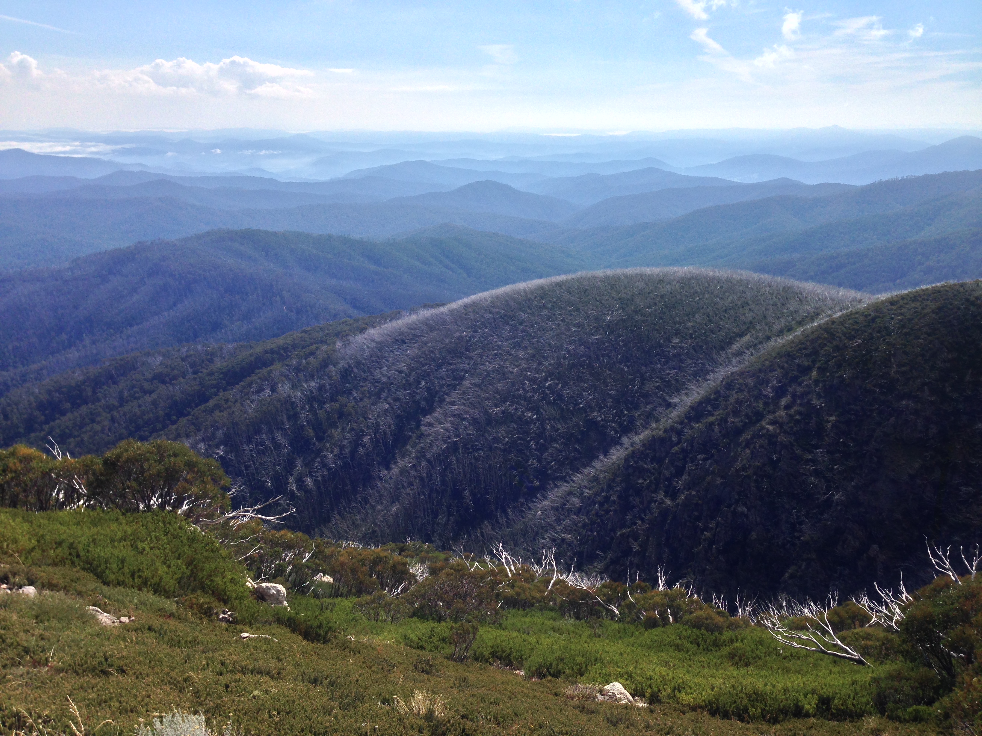
This wasn’t the peak but I think it was my favourite part of the walk. The sky was clear, the sun bright, and mountains sprawled out as far as I could see. We sat down and just looked at the view for a while, before continuing on to the top.
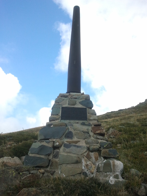
It wasn’t long until we reached the Gadsden Memorial Cairn, This is a plaque to commemorate the death of four walkers who died at that spot in a blizzard in August 1943. It just makes you think. It may not be the highest mountain ever, but with the lack of shelter and quick changing weather, things can still go wrong very quickly.

We continued on to the summit, which is marked by a large mound of stones. Tired and hungry, we sat down and had some lunch. As I sat there looking around the first thing that occurred to me was the silence. There was literally no sound. No buzzing flies, no wind, no birds, nothing. It was peaceful, we just sat in silence for a moment just listening to the sound of nothing.

I got up to walk around and take in the view. It was nice, not the best view I’ve ever seen, but I could still appreciate it. The weather started to change quickly. The wind picked up and cloud started to move in and out at an astonishing speed. Typical, this happens just as we go to take photos!
We walked across the top of Mt Bogong and started to descend down the Eskdale Spur, which was 5.5km. It was nice zig zagging down the narrow path with the mountain ranges in front of us and then we started to enter into the trees again. From this point on it was hard enough. The track was narrow and steep, and the stones underfoot were loose. Progress was slow and I started to get blisters on my toes.
Once we made it to the bottom of the Eskdale Spur it was a long 8km walk along a 4WD track back to the Mountain Creek Camping Area. This part of the walk would be nice on any other occasion. The path is wide and flat and takes you through lush forest and over streams, but with my blisters and aching legs I had little interest and just wanted to get back to the campervan, I was wrecked! And the track seemed to go on forever and ever. Although I did see my first snake, a black one, which I almost stepped on in the middle of the path. Luckily it didn’t challenge me, but just slithered away.
Finally at 4pm, 7 hours later, we finished the loop and made it back to our campervan. I sat down in the front seat and just didn’t move for a while. I hadn’t felt this tired in a long time! I suddenly realised that I hadn’t put enough sun cream on or drank enough water. I was seriously dehydrated, had a splitting headache, and didn’t feel good at all. But I knew I’d live!
For my first hike in Australia the Mt Bogong day walk wasn’t bad. My estimate is that the loop’s about 20km. It’s tough enough as the incline and decline is pretty short but steep, but just drink enough water, bring some sun cream, and there shouldn’t be any problems for a person of average fitness!
Vicki Larkin
